A call or visit to three governmental offices should disclose most regulatory issues involving land. These organizations have a wealth of information that can be useful. Contact (or use the links to the web sites at the end of this discussion), the Michigan Department of Environment, Great Lakes, and Energy (EGLE), the County Health Department in the county where the land is located, and the Township/County Zoning Administrator. Ask:
 *EGLE: “Would you please check if there are any designated special areas (rivers, erosion areas, endangered species, critical dunes, wetlands, known pollution problems), or anything else I should know before I buy this property?” EGLE maintains a database that flags problem areas in each square mile.
*County Health Department: “Would you expect perc or well problems on the property in which I am interested.” They will have the facts on nearby wells and perc tests.
*Township Supervisor or Zoning Administrator: “What does the zoning allow? Do you know of anything I should know before I buy this property?” These officials are closest to the land, live in the community, and should know of any obvious problems.
Endangered species
Piping plover, eagles, barred owls, Kirtland warblers, wolves, moose, ladyslippers and Lake Huron pansies are just a few of the endangered or threatened species found and protected in the U.P. under this act. The U.P. really is “like it used to be”: Endangered species can be found almost anywhere. That they still live here is reason for celebration. We need to be good stewards of the land. The Michigan DNR is responsible for endangered species issues.
Floodplains
Building in high risk flood areas is restricted for the safety of the owner and to insure that the natural flood flows of the river are allowed to dissipate as quickly as possible. Permits are required from the Land and Water Management Division, EGLE, and from local building and zoning organizations.
Great Lakes Submerged Lands
In general the public has the right to use the surface waters of the State of Michigan, so long as their access to the water is legal. Regardless of the location of the surveyor”s “meander line” along the shore, which is always located back from the water at the discretion of the surveyor, and regardless of the level relative to the ordinary high water mark, the riparian (waterfront) owner owns and controls his property to the water”s edge. On rivers and streams and some inland lakes an owner may also own bottomlands. On the Great Lakes Michigan Common Law provides that if you have gained lawful access to the water, you may walk along the shore provided you remain in the water.
On the Great Lakes Permits are required for filling, dredging and permanent structures such as piers, pilings, etc. lying below the Ordinary High Water Mark (OHWM) and on all upland channels extending landward of the OHWM of the Great Lakes. Contact the Land and Water Management Division of the Michigan Department of Environmental Quality, the US Army Corps of Engineers” Detroit District Engineer”s Office, and local and county regulators.
Great Lakes Shoreline
Environmental areas, flood risk areas and high erosion areas that may be damaged by various land use activities along the Great Lakes shoreline generally require permits from the EGLE Land and Water Management Division as follows:
- Designated Environmental Areas require permits for dredging, filling, grading, and alteration of natural drainage, alteration of vegetation used by fish and wildlife, and placement of permanent structures.
- Designated Flood Risk Areas require a permit for permanent structures on a parcel of land of which any portion is designated.
- Designated High Risk Erosion Areas require a permit for the erection, installation or moving of a permanent structure on a parcel of land of which any portion is designated.
- Setbacks from the water, or the “green line” where beach grasses begin to grow, or the tree line where the forest begins, are required under most zoning ordinances.
Inland Lakes and Streams
A permit is required from EGLE to affect bottomlands by dredging or filling; constructing or altering structures; creating, enlarging or diminishing an inland lake or stream, or interfering with the natural flow of water. Setbacks from the water are required for structures under most zoning ordinances.
Natural Rivers
Several outstanding rivers including the Fox and the Two Hearted River (and most of their tributaries) are in a designated Natural River District. All lands within 400 feet of the river are protected and permits are required for any building construction, platting of lots, cutting of vegetation, land alteration or bridge construction. Township/county zoning administrators controls permits in areas with approved Natural River zoning. The state zoning administrator controls permits in State-zoned areas of Natural Rivers. Contact MDNR Forest Management Division, Natural Rivers Program — Doug Carter, 517 373-1175 or Dan Pearson, 517 335-3441.
Sand Dunes
In designated and mapped critical dune areas all proposed new uses that significantly alter contours, including roads and recreational and silvicultural (forest management) activities, require permits from EGLE.
Soil Erosion and Sedimentation Control
Permits are required for all earth changes that disturb one or more acres of land or are within 500 feet of a lake or stream. The regulatory bodies may include the county, EGLE, DNR, charter townships, cities and villages.
Toxic Materials
Radon (new window – EPAinformation) is a colorless, odorless, radioactive gas that occurs in some areas of the UP (and throughout the U.S.) and can, in sufficient concentrations, represent a health hazard. It is a good idea to have existing structures tested for radon accumulations.
Lead based paint (new window – HUD information) that can be a health hazard may be present in residential structures built prior to 1978 may contain lead . Purchasers of such housing should obtain and read the HUD-EPA information pamphlet about Lead-Based Paint: Protect Your Family
Mercury
The DNR fishing guide lists some lakes and streams where the fish should not be eaten because of naturally occurring mercury in the water. (These are some of the best fishing spots for us “catch and release” types!)
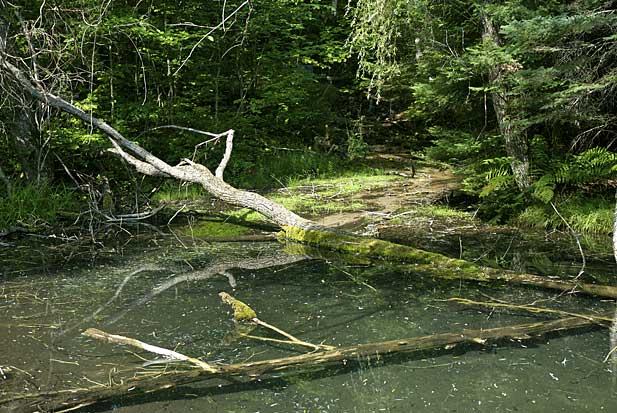
Wetlands
A “wetland” is sometimes not obvious and may not be identified by standing water or even a high water table but by soils, vegetation or other factors. The EGLE determines if lands are “wetlands”. If so they cannot be disturbed by filling, dredging, developing (including building structures or roads), or draining the wetland. Permits are obtained from the Land and Water Management Division of EGLE, the US Army Corps of Engineers, and various other local regulators.